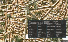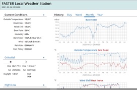
One of the tools developed within the FASTER project is the Local Weather Station (LWS) to help first responders in the field adjust their missions to weather conditions: temperature, humidity, and wind speed and direction.
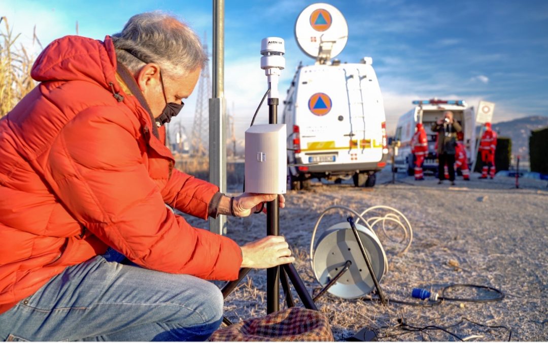
The LWS was tested in the FASTER pilot in Moncalieri, in a scenario of flooding, being considered by the first responders – the end-users of the project – as an essential tool to operate safely while deploying the operation vehicles. The LWS is easy to install and rapidly made operational, with an efficient and simple integration with communication systems, due to adoption of standard protocols, allowing to access data in real-time and supporting decision-making in rescue missions.
The LWS is a sensor to measure weather related parameters, designed without moving parts: making its deployment easy by the response teams. The LWS has capability to connect to the local Wi-Fi networks and to cable networks, as well as to the UAV relay mesh networks therefore being an important tool communicating with other devices operating in the mission field.
Additionally, the LWS also sets the geographical positions automatically and can provide a local interface to validate the adequate functionalities and relevant information to feed into the FASTER system. This interface is available both in the Global Common Operating Picture (GCOP) and in the Portable Common Operating Picture (PCOP).